Vang
Municipality · Innlandet
About Vang
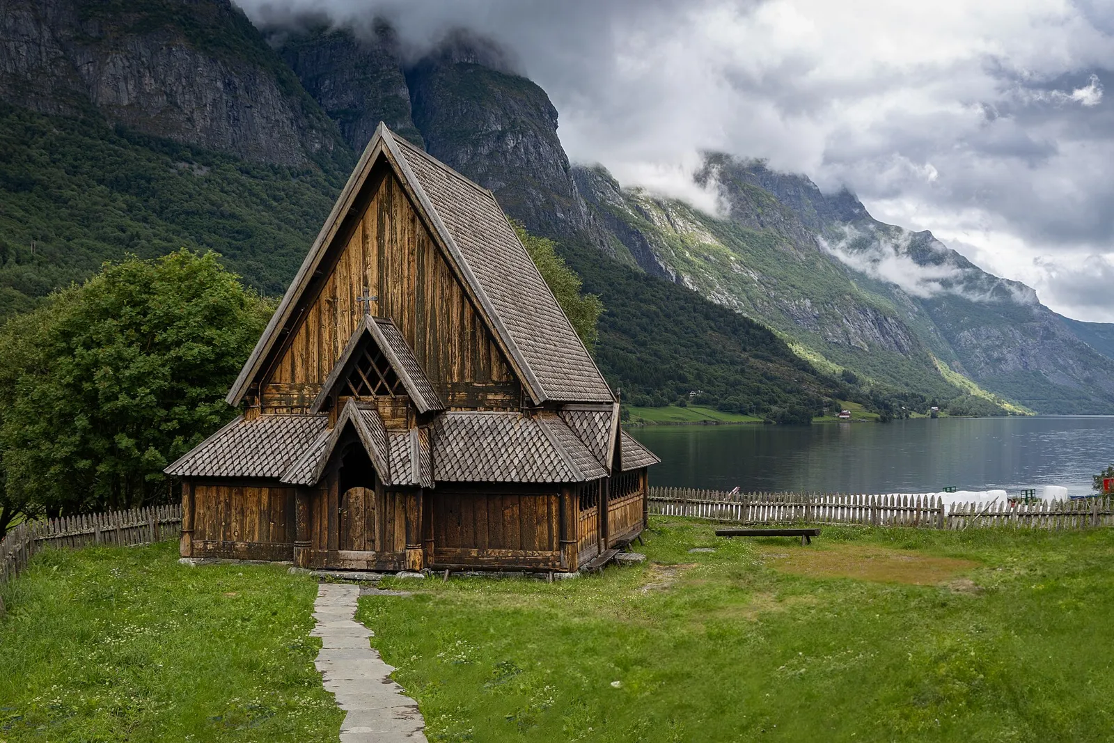
Høre and Øye stave churches, and Lake Tyin below Jotunheimen.
What to do and where to stay in Vang
Places to stay are run locally, with no hotel or campsite chain behind them.
1Høre Stave ChurchHistory & culture
Tree rings date it to 1178–79, and runes on the pulpit say two brothers had the timber felled the summer Erling Jarl fell in Nidaros, the battle of 1179.
Kvien, hillside above the E16 east of Vang · 30–60 min · summer for the interior; outside all year
2Vang Stone (Vangsteinen)History & culture
A runestone from around 1000 in Ringerike style with a carved lion-like beast; it says Gåse's sons raised it for their nephew Gunnar, and stands outside Vang church.
In front of Vang church, Vang (Grindaheim), by the E16 · 15–20 min · all year
3Øye Stave ChurchHistory & culture
A small 12th-century stave church that once stood in the fields by Vangsmjøse, put back up in 1965 partly from its surviving original timbers.
Øye, west end of Vangsmjøse by the E16 · 30 min · summer for the interior
4Sparstadstølen in SanddalenFood & drink
A working summer farm in a side valley north of Vangsmjøse, revived in 1996, serving sour cream porridge and cured meat and selling its own butter and brown cheese.
Sanddalen, north of Vangsmjøse, via Vennis (last 7 km private toll road) · 1–2 h · 4 July – 15 August 2026
5Sputrefossen (Givrisfossen)Nature
A short, steep walk of about 1 km and 120 m up from the Slettefjellvegen toll bar leads to this splashing waterfall, named Givrisfossen on maps after the Givre farm.
Hensåsen, off the E16 up Slettefjellvegen · about 40 min (2 km return) · May–October (best in early summer)
6Watermills at Leine creek, VennisHistory & culture
Six old mills still stand along the Leineåne stream, where 13 once stood before the great flood of 1860; in 1729 Vang had 79 mills.
Vennis, north side of Vangsmjøse · 30–45 min · May–October
7King's Road over Filefjell: Kyrkjestølen – MaristovaHike
A 10.7 km one-way walk on the 1790s royal road, past St Thomas church and its highest point at about 1,200 m, ending at Maristova in Lærdal.
Kyrkjestølen on Filefjell, by the E16 · 2–4 h one way (10.7 km) · May–mid October
8St Thomas Church, FilefjellHistory & culture
A 1971 church on the site of a stave church to Thomas Becket, where a service every 2 July drew travellers from Valdres and Sogn to a summer gathering until the 1800s.
Kyrkjestølen, Filefjell, by the E16 · 15–30 min · all year (outside)
9Eidsbugarden and the Vinje memorialHistory & culture
A summer road from Tyin ends at Bygdin's west end, where the poet A.O. Vinje set up his hut in 1868; a memorial to him was raised in 1959.
West end of Bygdin, Fv 252 from the south end of Tyin · half day with the drive · summer (Fv 252 is a summer road)
10Riddarberget at HøreHike
A signed culture walk from Høre school past the stave church to the walls of an old hill fort, about 150 m long and 75 m wide.
Høre forest; park at Høre school (E16 exit Ryfoss, road 293 towards Høre) · 1–2 h · May–October
Nearby, also among the best for national tourist routes
- Øystre SlidreInnlandetNational Tourist Routes (among Norway's best)Skiing (among Norway's best)
- LærdalVestlandNational Tourist Routes (among Norway's best)History (among Norway's best)
- LomInnlandetNational Tourist Routes (among Norway's best)Mountains (among Norway's best)
- VågåInnlandetNational Tourist Routes (among Norway's best)Hiking (among Norway's best)