Værøy
Municipality · Nordland
About Værøy
Hike to the abandoned village of Måstad, home of the puffin-hunting Lundehund dog, or up the radar-station road on Håen for bird-cliff views.
What to do and where to stay in Værøy
Places to stay are run locally, with no hotel or campsite chain behind them.
1Måstad abandoned villageHike
A former village of puffin catchers on the island's south tip, left because it had no road or proper harbour, where the six-toed Lundehund dog breed survived.
Måstad, south end of Værøya · 4–6 h (about 15 km return, 750 m ascent) · June–September (snow-free); puffins on the cliffs roughly May–August
2Håheia via the radar roadViewpoint
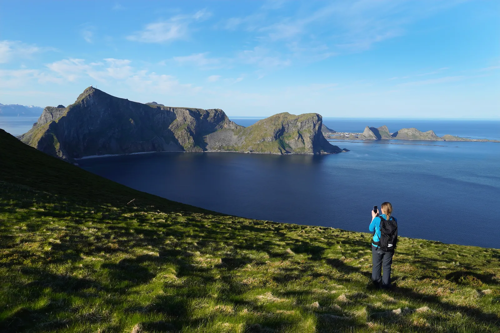
A 2.5 km climb from Sørland, partly on the road to the radar station, to 438 m with views over Måstad, Mosken and the Lofotodden peaks.
Above Sørland, start at Rømdalen · 2–3 h (5 km return) · April–October
3Eagle-catchers' stone huts on HåenLocal oddity
Small stone-slab pits about 1.5 m across where men hid and caught eagles by hand, up to 252 in one season, until eagles were protected in 1968.
Halfway up Håen/Håheia, above Måstad · On the Håheia hike (add 15 min) · April–October
4NordlandsnupenHike
Værøy's highest peak at about 450 m, a short steep climb from Breivika with a chain-assisted rock step near the top and a 360-degree view.
Breivika, north side of Værøya · 2.5–3.5 h (about 4 km return) · June–September
5Old Værøy ChurchHistory & culture
Lofoten's oldest church still in use, a small red timber long church that was taken down in Kabelvåg and rebuilt at Nordland in 1799.
Nordland, north side of Værøya · 20–30 min · All-year; check opening hours before you go
6Puinn Sand beachNature
A sandy beach on the island's west side that can only be reached by boat, with a cave nearby where paintings thought to be about 3,500 years old were found.
West side of Værøya · Half day including boat · Summer, calm weather only
7Røssnesvågen and Værøy lighthouseHistory & culture
An old fishing settlement at the island's southeast point with preserved buildings and an 1880 lighthouse, restored after standing empty from 2007 to 2019.
Røssnesvågen, southeast tip of Værøya · 30–60 min · all-year
8Lofoten Værøy Brygge restaurantFood & drink
A restaurant on the quay edge near the ferry landing in Sørland, serving local seafood such as halibut and stockfish.
Harbour, Sørland · 1–1.5 h · Reopened in May 2026; check opening hours before you go
9Nordlandshagen beach and the old airstripNature
A beach on the north side with a water tap and toilet where the Måstad trail starts, beside the airstrip that served Værøy only from 1986 until a fatal crash in 1990.
Nordland, north side of Værøya, about 4 km from Sørland · 20–30 min (or start of the Måstad hike) · all-year
10Værøy Church, SørlandHistory & culture
The island's working church, a brick building from 1939 in Sørland with about 310 seats, restored in 1984; easy to combine with the ferry quay.
Sørland · 15–20 min · All-year; check opening hours before you go
Nearby, also among the best for islands & island hopping
- RøstNordlandIslands & island hopping (among Norway's best)Wildlife (among Norway's best)
- MoskenesNordlandIslands & island hopping (among Norway's best)Mountains (among Norway's best)
- FlakstadNordlandIslands & island hopping (among Norway's best)Mountains (among Norway's best)
- VestvågøyNordlandIslands & island hopping (among Norway's best)History (among Norway's best)