Nannestad

Municipality · Akershus
About Nannestad
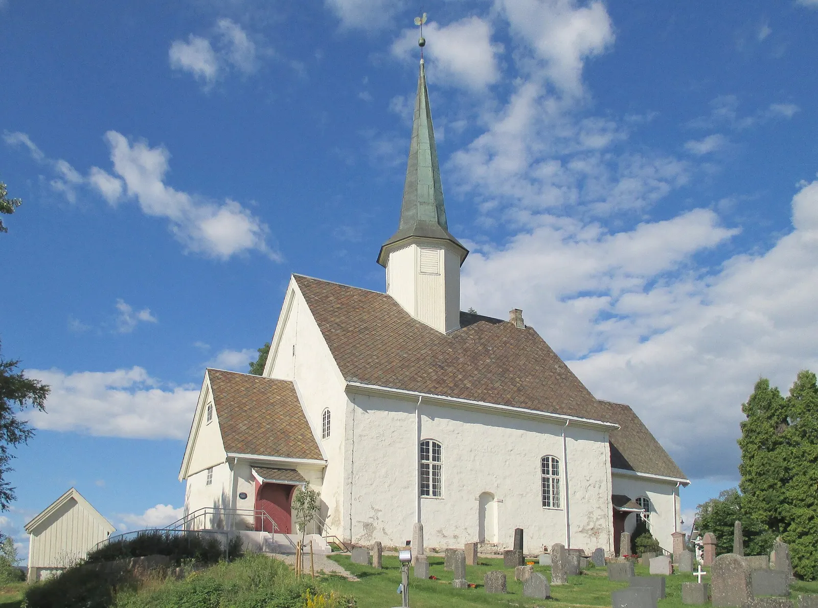
A stone church from around 1200 with a runic soapstone font from the 1140s, and ski or hiking trips up Marifjell to its summit cabin.
What to do and where to stay in Nannestad
Places to stay are run locally, with no hotel or campsite chain behind them.
1Nannestad kirkeHistory & culture
A stone church from around 1200 with a runic soapstone font from about 1140; Birkebeiners sheltered here after the 1240 battle at Låke, and in 1814 it held the first round of Eidsvoll elections.
By Låke farm, Nannestad · 20–40 min · outside all year; inside – check opening
2MarifjellHike
Nannestad's highest point at 717 m, with a tourist cabin on top that was a fire-watch hut until the 1950s and a new fire tower from 2014 with views over Romerike.
Northwest Nannestad, from the Nordåsen ski stadium car park · Half day · all year (skis in winter)
3Holter kirkeHistory & culture
A medieval log church first named in a charter in 1304, made taller in 1697; its pulpit is thought to belong to the original interior.
Holter, Nannestad · 15–30 min · outside all year; inside – check
4RåsjøenNature
A forest lake at 436 m in the Romeriksåsen hills, once a royal common with sawmill and forge, now a hub for gravel cycling and ski trails beside a 1913 hunting lodge.
Romeriksåsene, west Nannestad · half day · summer–autumn by bike/foot, winter on skis
5VikkelihyttaHike
A DNT hut owned by the Nannestad commons, about 5 km on a blue-marked trail from Marifjell, by a lake with fishing and swimming; day visitors may drop in 12–16 when not booked.
Romeriksåsene, Nannestad (trail junction towards Marifjell) · half day (about 9 km from Kløvberget bus stop; 4 km from Nordåsen in winter) · toll road about June–1 November; on skis in winter
6Vigstein grave field and standing stoneLocal secretHistory & culture
An Iron Age grave field with 50 burial mounds at nine spots and a standing stone about two metres tall in Nannestad. Likely farmland: ask first, keep off the mounds.
Vigstein, Nannestad · 20 min
7Raudfjell lookout towerLocal secretViewpoint
One of the newest towers in Oslomarka, with views east over Romerike and west across Romeriksåsen; an easy 8.3 km return walk from Eltonåsen, bus stop Holter sag nearby.
Start at the Romerike Almenningsdrift sign on Øyungsvegen, Eltonåsen · 2–3 h · May–October
8Aurmoen dunes and kettle lakesLocal secretNature
A protected patch of wind-blown sand dunes, meltwater channels and five kettle lakes beside Gardermoen airport. Don't swim in Aurtjern when the blue-green algae bloom.
Aurmoen, near Sessvollmoen and Gardermoen, Nannestad · 1 h