Høylandet
Municipality · Trøndelag
About Høylandet
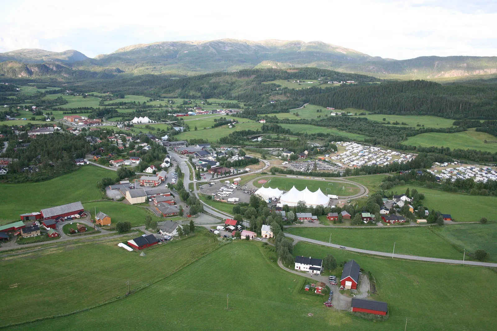
Home of the biennial Norwegian revue festival since 1987, with salmon in the Søråa, whooper swans on migration and the Kystriksveien coast road heading north.
Høylandet is one long north–south valley of farms, with steep granite mountains of 700–800 m on the east side and gentler peaks to the west. A string of lakes lies along the valley floor, and at the northern end a river runs down to Kongsmoen at the head of a fjord arm.
It is a quiet stretch where the coast road meets the road from Grong. Stop for the 75 m Grongstadfossen or the roofed timber bridge at Hammer, or bike the flat gravel loop around the biggest lake.
Good to know
- Getting there: Fv17 comes up the valley from Namsos, Fv775 from the E6 at Gartland. About 25 min from Grong, 55 min from Namsos.
- Season: Grongstadfossen is at its biggest in the spring melt and after heavy rain; the Øyvatnet bike loop is for May–October.
- Sleeping: Two campsites: Flåt Camping (April–October) and Rydningsodden Camping.
What to do and where to stay in Høylandet
Places to stay are run locally, with no hotel or campsite chain behind them.
1GrongstadfossenNature
A 75 m waterfall on the Nordåa, signposted from Fv17 just south of the centre, with a path from the picnic spot down along the river for a better view.
Just south of Høylandet centre, off Fv17 · 20–45 min · all-year; biggest in spring melt and after heavy rain
2Hammarsbrua (Hammer covered bridge)Local oddity
A roofed timber bridge from the 1920s at Hammer, one of few of its kind in Norway and listed as heritage; nobody knows for sure why it was given a roof.
Hammer, on the old road towards Tyldum, south of Høylandet centre · 15–30 min · all-year
3Bremburunden walk and HammarsbakkenHike
An easy 4.5 km loop from the sports ground over the covered Hammarsbrua and up Hammarsbakken, with a view across the valley towards Grongstadfossen.
Starts at the sports ground (idrettsanlegget), south of Høylandet centre · 1 h (4.5 km loop) · snow-free season
4Høylandet Church and the Høylandet tapestryHistory & culture
The 1860 wooden church holds a hand-woven copy of a medieval tapestry from this church showing the Three Wise Men; the original is in Nasjonalmuseet.
North side of Høylandet village, by Fv17 · 15–30 min · all-year; interior usually only at services or by arrangement
5Øie Nature ReserveNature
A small wetland where the Øyelva meets Øyvatnet, with a bird-watching balcony; whooper swans are common here on spring and autumn migration.
North end of Øyvatnet, about 8 km north of Høylandet village · 30–60 min · best April–May and September–October for migrating swans
6Lille Flakkenrunden and Flakkan Nature ReserveHike
A 9 km walk or bike loop from the sports ground via farm roads, Flakken bridge and the church, with a detour to Flakkan reserve for redshank, swans and beavers.
Loop from Høylandet sports ground north to Flakken · under 2 h (9 km loop) · snow-free season
7Øyvatnet RundtActivity
A flat, roughly 20 km bike loop on gravel roads by Øyvatnet, the biggest lake on the Søråa river system, passing the Øie reserve and its bird-watching balcony.
Around Øyvatnet, north of Høylandet village · 1.5–2.5 h by bike (about 20 km) · May–October
8Kongsmoen and Kongsmo ChapelHistory & culture
A small village at the very head of the Foldafjord, with a white 1937 long-church chapel by architect Simon Fuglstad.
Kongsmoen, about 30 km north of Høylandet village · 20–40 min · all-year
9Søråa salmon riverNature
A calm salmon river that runs just under 20 km from Øyvatnet down the main valley, holds salmon along its whole length and is easy to reach from the road.
Main Høylandet valley, between Øyvatnet and Grungstadvatnet · 30 min stop or a fishing day · salmon season in summer; riverside all year
10Drageid ChapelHistory & culture
A small, many-sided brown wooden chapel from 1976 at Vassbotna, on the narrow strip of land between the Eidsvatnet and Grungstadvatnet lakes.
Vassbotna, southern Høylandet, about 11 km southwest of Høylandet village · 15 min · outside all year; inside at services