Færder
Municipality · Vestfold
About Færder
The islands of Tjøme and Nøtterøy, the tipping-lantern beacon at Verdens Ende and skerry-hopping in Færder National Park.
What to do and where to stay in Færder
Places to stay are run locally, with no hotel or campsite chain behind them.
1Verdens Ende and the tilting lighthouseSight
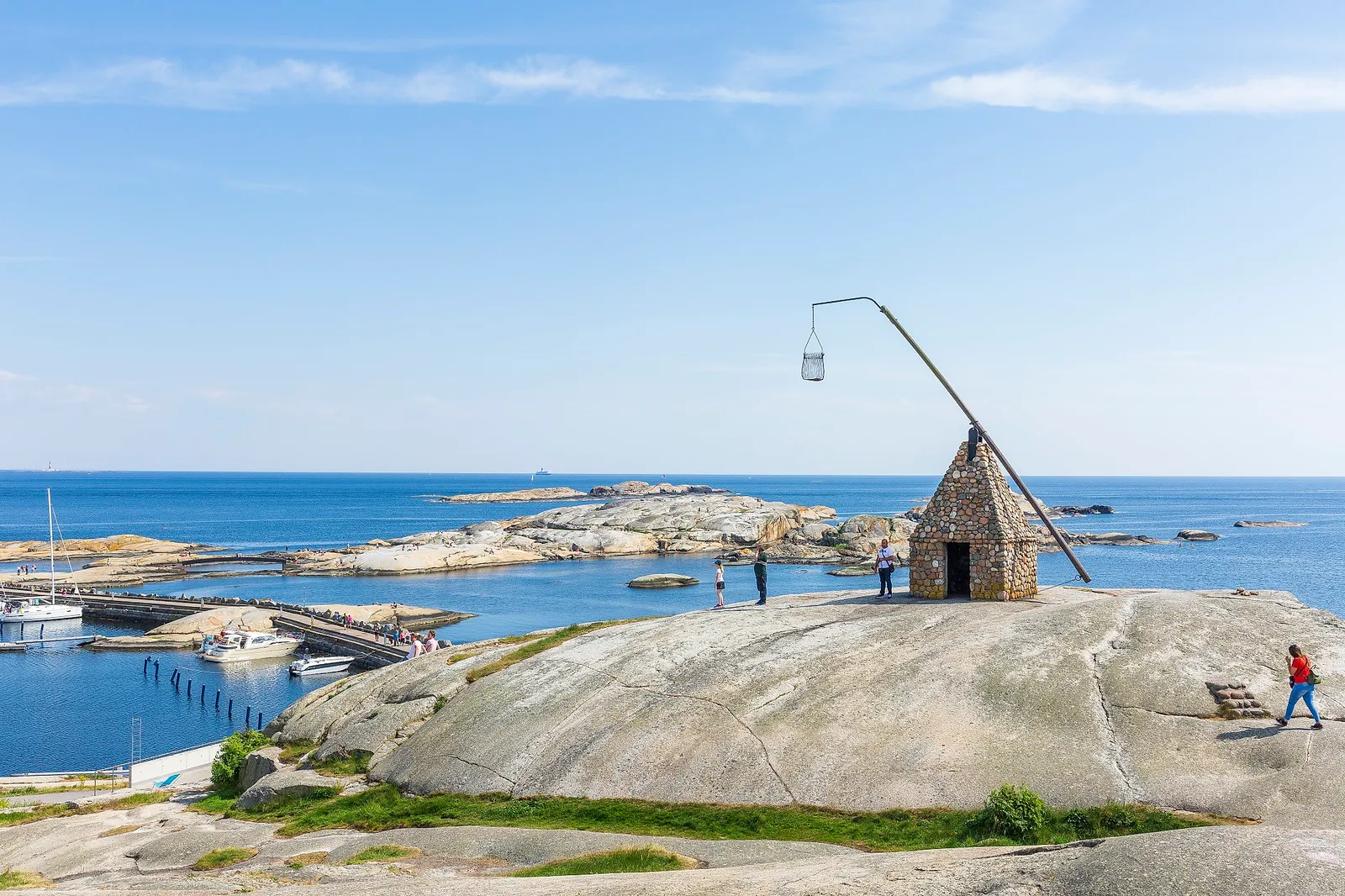
The southern tip of Tjøme, with a tilting beacon built in 1932 from beach pebbles, smooth granite to swim from and a view out to Færder lighthouse.
Helgerødtangen, southern tip of Tjøme · 1 h · all year
2Færder National Park visitor centreHistory & culture
Free exhibitions on sea and coastal life in the 340 km² island park, with a panoramic room looking over the skerries to Færder lighthouse, right at Verdens Ende.
Helgerødveien 590, Verdens Ende, Tjøme · 45 min · all year, Tue–Sun 12–16 (2026); longer in school holidays
3Moutmarka round walkHike
An easy 3.2 km loop through coastal pine forest and over rocks in the national park, past Mostranda beach and a WWII searchlight post at Skåetangen.
Moutmarka, just north-west of Verdens Ende, Tjøme · 1 h (3.2 km loop) · all year; nightingales from mid-May
4Torås fortHistory & culture
A coastal fort begun in 1939 and continued by the German occupiers, now abandoned; the grounds are open all year and a small museum opens at summer weekends.
About 2 km north of Verdens Ende, Tjøme · 1 h · outdoor area all year; museum and café summer weekends
5VeierlandNature
A quiet farming and forest island in Tønsbergfjorden, reached by a daily ferry from Tenvik on Nøtterøy, with beaches and a wooden church from 1905.
Tønsbergfjorden, ferry from Tenvik on Nøtterøy · half a day · all year; summer best
6BolærneNature
An island group lived on from 1645 to 1962, whose 1820s quarry gave stone for the Royal Palace and which later held a fort; a summer fast boat runs from Tønsberg.
Outer Oslofjord, east of Nøtterøy · half a day · summer (boat from Tønsberg)
7Nøtterøy churchHistory & culture
A medieval stone church whose west nave and tower base date from the 1100s, and one of the churches where Norwegians voted for the Eidsvoll assembly in 1814.
Nøtterøy · 20 min · outside all year; inside check
8MostrandaSwim
A public sandy beach at the north end of Moutmarka, the coastal pine forest at the land end of Færder National Park, with marked fire spots.
Mostranda, south Tjøme · 1–2 h · summer
9Spiseriet Verdens EndeFood & drink
A restaurant in the national park centre at Verdens Ende with a big terrace facing the sea, serving light meals and mains.
Helgerødveien 590, Verdens Ende · 1 h · own hours – check
10Hvasser and SandøsundSight
An island with the outer Oslofjord pilot station, a fishing harbour at Sandøsund and several protected beaches, at the edge of the national park.
Hvasser, east of Tjøme · 1–2 h · all year; summer best