Etnedal
Municipality · Innlandet
About Etnedal
Hike or ski up Spåtind, Etnedal's highest peak, then fish for native trout or paddle the Etna river through the valley.
What to do and where to stay in Etnedal
Places to stay are run locally, with no hotel or campsite chain behind them.
1Spåtind from FjellsætraHike
A marked path climbs 622 m from birch forest to the 1,414 m top of Synnfjellet, with Rondane to the east and Jotunheimen and the Hemsedal mountains to the north-west.
Fjellsætra, about 14 km north of Bruflat via Rust (gravel toll road) · 4 h (about 12 km return) · June–October (ski touring in winter)
2LundebruaHistory & culture
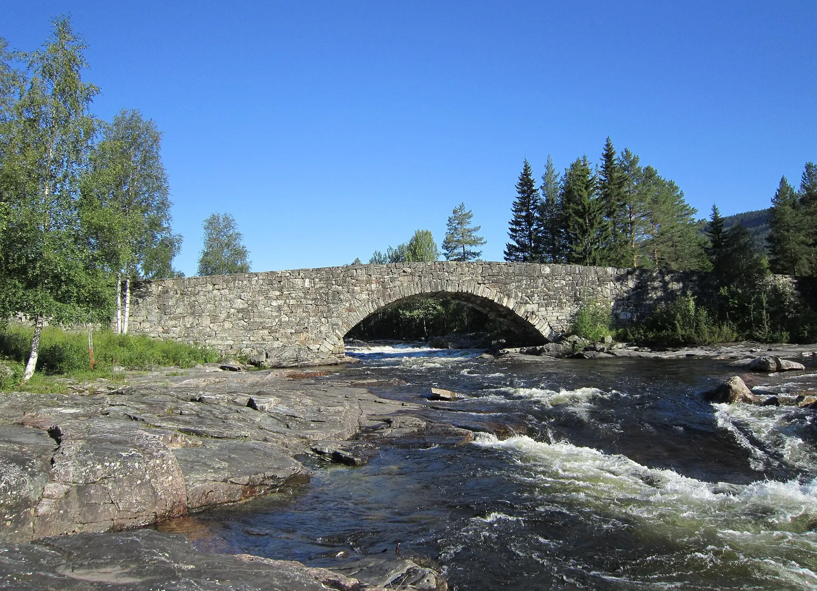
Built 1827–29 for the Bergen royal road, the 132 m dry-stone arch bridge is the oldest and largest of its kind still carrying traffic in Norway, with a rest and swim spot.
Lunde, Etnedal · 20–45 min · all year; swimming in summer
3JuvfossenNature
The Åfeta river falls freely about 40 metres in one drop, close to Fv 251 between Flatøydegard and Rust.
By Fv 251 between Flatøydegard and Rust · 15–30 min · May–October, best in spring flood
4Kongevegen over TonsåsenHike
The Bergen royal road of 1793 survives largely intact from Bruflat over Tonsåsen and is marked for walking, about 7.5 km with 560 m of climbing and restored milestones.
From Bruflat to Tonsåsen · 2.5–3 h (about 7.5 km, 560 m climb) · May–November
5BreiesleirenHistory & culture
Three huts on a hill above Bergatjedne sheltered up to 25 resistance people in winter 1944–45, among them eight Russian prisoners who learned to ski to flee to Sweden.
Tonsåsen, off Breiesvegen from Fv 235 · 3 h (8.4 km return) · May–November
6Høljarast battle siteHistory & culture
Etnedal's fighting in April 1940 began at Høljarast bridge, which Norwegian troops blew up as they fell back; a cleared war-history trail with boards tells the story.
Høljarast, by Rv 33 between Aurdal and Dokka · 30–60 min · all year
7Bruflat ChurchHistory & culture
A cross church from about 1750 that was moved to Bruflat in 1774, its interior restored in 1974–75.
Bruflat, Etnedal centre · 20 min · outside all year
8GoarenViewpoint
A short hike of about 2 km and 180 m of climbing from Klokkerlie to the 1,065 m top over summer-farm land at Tangen, with wide views across Valdres.
Above Steinsetbygda · 1.5 h (about 4 km return) · June–October
9Vardafjell (Dalavardin)Hike
A short marked-then-clear path past an old summer farm in Kristofferdalen, used until 1967, to a summit boulder at 989 m with wide views over Etnedal and Nordre Land.
Above Nyhus, north of Bruflat · 1.5 h (about 5 km return, 150 m climb) · June–October
10Bergflagget above HøljarastLocal oddity
High on the cliff above Høljarast, a Norwegian flag painted overnight on 8 July 1897 at a double wedding was a protest against the union with Sweden; you see it from the road.
Rock face above Høljarast, by Rv 33 between Aurdal and Dokka · 10 min · all year