Bardu
Municipality · Troms
About Bardu
Polar Park, the world's northernmost wildlife park with wolves, bears and lynx, plus the Troms Defence Museum at Setermoen and vast Lake Altevatn.
What to do and where to stay in Bardu
Places to stay are run locally, with no hotel or campsite chain behind them.
1Polar ParkSight
Opened in 1994 and billed as the world's northernmost animal park, with wolves, bears, lynx, wolverines and musk ox in 12 large enclosures in Salangsdalen.
Bonesvegen 319, Salangsdalen, 3 km off E6 · 2–3 h · all-year daily (summer 21 June–31 Aug 10–18; rest of year 10–15:30); closed 17 May and 24 Dec
2Troms Forsvarsmuseum (Troms Defence Museum)History & culture
In Norway's largest garrison town, the museum covers the 1940 Narvik campaign run from Setermoen, Cold War NATO exercises and two German Panzer III tanks.
Setermoen · 1–1.5 h · all-year Tue–Thu (2026: 10/11–15; summer 29 June–2 Aug 11–16)
3Bardu ChurchLocal oddity
An eight-sided white wooden church finished in 1829, modelled on Tynset church by settlers from Østerdalen and Gudbrandsdalen who moved here from the late 1700s.
Setermoen · 15–20 min · all-year (outside)
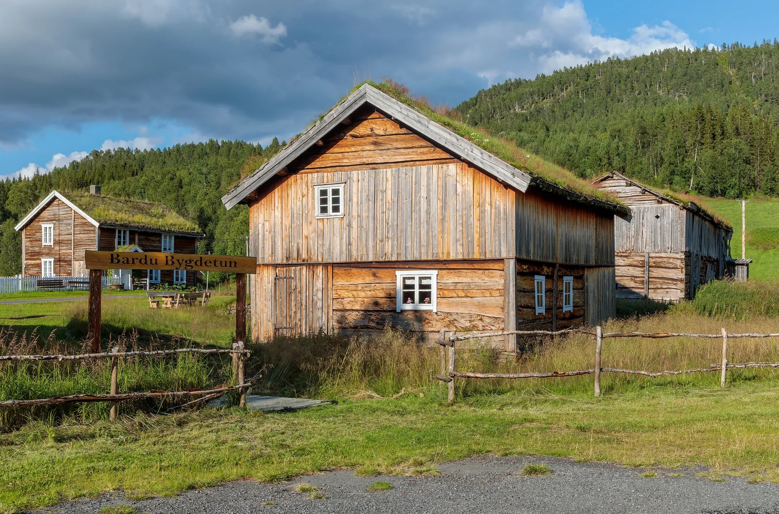
4Bardu Bygdetun (Lundamo)History & culture
A settler farm founded in the 1860s with turf-roofed log buildings – main house of 1868, cowshed, smithy, mill and schoolhouse – kept as a rural museum since 1969.
Lundamo, Salangsdalen, by E6 about 10 km south of Setermoen · 30–45 min · Outside all-year; interiors summer; check opening hours before you go
5Altevatnet and AltevasshyttaNature
Troms' largest lake runs 56 km towards Sweden; at the road's end by the dam, a DNT cabin open all year sits 200 m from the car park on the Nordkalott route.
West end of Altevatnet, beyond Innset · half a day (about 40 km each way from E6) · all-year (road ploughed to the car park in winter)
6Rohkunborri National Park and SørdalenNature
A 556 km² park from 2011 with small glaciers, Bardu's highest peak (1,659 m) and the Sørdalen gorge cut by Ice Age meltwater; wolverines and gyrfalcons live here.
Sørdalen, south of Altevatnet · half a day to several days · June–September for walking
7Sir Henry's WaterfallNature
A short path from a small E6 lay-by crosses a bridge to a view of a waterfall in Salangsdalen, a few kilometres north of the Polar Park turn-off.
By E6 in Salangsdalen, north of the Polar Park turn-off · 10–15 min (about 460 m, nearly flat) · May–October
8Elveparken along BarduelvaHike
A 4.3 km flat riverside path below Setermoen centre, part of Bardu's millennium site, with benches, fire pits and loops on both sides of the river.
Setermoen, from the church, the bus stop or Sponga bridge · 1 h (4.3 km one way) · April–October
9Rubbsnytten (665 m)Viewpoint
A clear path from Sørdalen climbs about 590 m to a 665 m top looking over Bardudalen, Sørdalen towards Sweden and Østerdalen towards Altevatnet.
Sørdalen, start by Sørdalen grendehus near Øvre Bardu chapel · about 4 h (8.7 km return, 594 m ascent) · May–September
10Domus Kafé, SetermoenFood & drink
A simple café in central Setermoen open six days a week, serving coffee, wraps and a house burger.
Gammelveien 8, Setermoen · 30–45 min · all-year (Mon–Fri 9–18, Sat 10–16, Sun closed)